More than two years after road access and electrical power to the Mauna Loa Observatory was cut off by lava flows, NOAA staff continue to make critical measurements of the atmosphere and other environmental variables at the remote site.
In 2023, observatory staff installed solar panels at the site and resumed some measurements, including the independent carbon dioxide monitoring programs run by the Global Monitoring Laboratory and Scripps Institution of Oceanography, as well as other atmospheric measurements.
Construction of a temporary road to access the observatory site is anticipated to begin in summer 2025.
Media can contact: Theo Stein (303) 819-7409 (theo.stein@noaa.gov)
Organization(s):
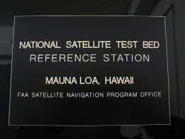
 Federal Aviation Administration (FAA) & Stanford University
What does this program measure?
A Global Positioning System (GPS) reference station at Mauna Loa facility is used to derive column water vapor profiles.
How does this program work?
The system operates continuously and remotely. GPS data is communicated to Stanford University in real time.
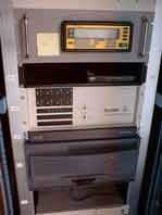
Instruments used include: computer, UPS battery backup, dual frequency GPS receiver, rubidium clock, weather sensor package, router, modem. A GPS antenna and a weather sensor will be mounted on the top of the tower.
Why is this research important?
The primary interest is to prototype the development of a high integrity wide area differential GPS correction service for aviation use. Key issues include geographic separation of Hawaii from CONUS, the ionosphere at low altitudes, and the troposphere at high altitudes.

Are there any trends in the data?
How does this program fit into the big picture?
What is it's role in global climate change?
Comments and References
Lead Investigator(s):
Professor Per Enge
415-723-2853
MLO Contact(s):
Dr. John E. Barnes
808-933-6965
Darryl Kuniyuki
808-933-6965 (x236)
Web Site(s)
http://aa.stanford.edu/
aeroastro
Date Started
September, 1997

